Anchor year
1569
A round world, a flat page.
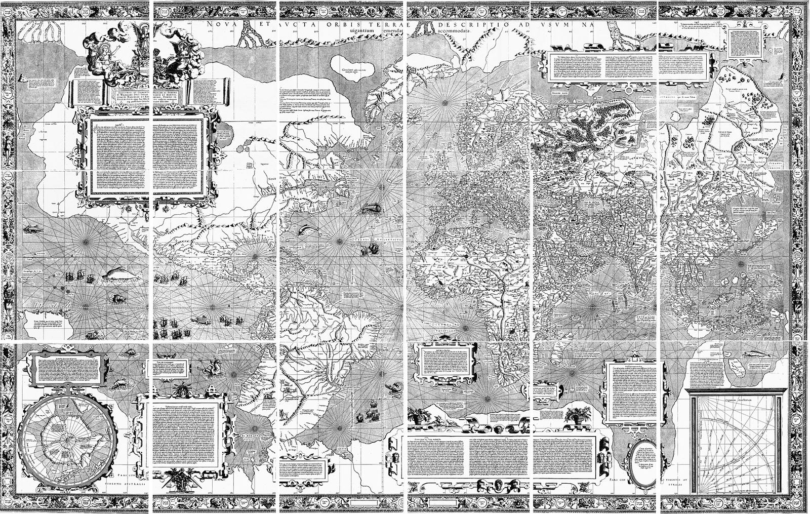
In 1569 Gerardus Mercator, a Flemish mapmaker living in Duisburg, published a large world map 'for the use of navigators.' On it, a ship that holds a steady compass bearing traces a straight line. The cost is paid at the poles, which swell. The map does not tell the truth about area. It tells a usable truth about direction.
How do you make a round world steerable on a flat page?
MAP
A map for sailors
Mercator published Nova et Aucta Orbis Terrae Descriptio ad Usum Navigantium Emendate Accommodata, a world map on a conformal projection that renders rhumb lines as straight lines. He did not publish the full mathematical method in 1569. That explanation came later, notably with Edward Wright (1599).
Before
Sea charts, globes, Ptolemy, and the 1500s explosion of Atlantic and Indian Ocean knowledge. Mercator had already made a globe (1541) and been imprisoned for suspected heresy in 1544.
Why
Portolan charts were locally superb and globally awkward. Ptolemaic maps were learned and not made for compass steering. Mercator tried to give navigators a sheet on which direction did not have to be constantly recomputed as a curve.
Who
Gerard de Kremer, born 1512 in Rupelmonde, trained at Louvain, instrument-maker, engraver, and cosmographer. In 1569 he was in Duisburg, not in a ship’s cabin. Sailors were the intended users, not the makers.
Gerardus Mercator (Gerard de Kremer) · Abraham Ortelius (contemporary, different project)
What
A wall-sized engraved world map that keeps angles locally true so that a constant compass course (a rhumb, or loxodrome) appears straight. Areas and distances distort, more and more toward the poles.
How
A projection that stretches meridians toward the poles. Mercator described the use more clearly than the construction. The later analytic form is not what 1569’s readers held in their hands.
The hinge
The hinge is the 1569 sheet itself: a claim that a particular distortion is the right distortion for a particular task.
Where, and when
A workshop in Duisburg. The map’s geography is the world as European compilation then had it: Atlantic, Indian Ocean, incomplete Pacific, invented or guessed polar zones. 1569, as printed on the map. It is a publication year, not a voyage year.
1569 · Duisburg, Duchy of Cleves
What they knew
He knew rhumbs were the sailor’s practical path, not great circles. He knew his map was for steering, not for comparing the true size of continents.
What they could not know
How completely later schoolrooms would treat his projection as 'the' world. How badly Greenland and high-latitude empires would look oversized. GPS, aviation great-circle routes, or the political arguments of the twentieth century about map justice.
Source object
Mercator world map of 1569
Original impressions are rare museum objects. Later copies and facsimiles circulate. This project does not pretend to display the copperplate. It describes the surviving map.
The object survives.
First record
The 1569 map is the first record of this projection in print.
After
Adoption was not instant. Wright’s mathematical treatment (1599) and later tables made it more usable. It became the default nautical and then classroom image of the world.
Later retelling
People say Mercator 'drew the world wrong.' He drew it for a job. The later crime, if there is one, is using a sailors’ tool as a political picture of who is large.
Limit
The projection’s later cultural life is not evidence that 1569 hid a philosophy of empire in a formula. Motive and later use are different questions.
What it does not prove
Does not prove that 69 favors maps, or that Mercator caused later colonial cartography in a single act.
Why it entered
It entered the test because a dated object solves a precise problem of direction, the same problem 1269 had posed with a stone.
Question
How do you make a round world steerable on a flat page?
How we know
- 1. Gerardus Mercator. Nova et Aucta Orbis Terrae Descriptio ad Usum Navigantium Emendate Accommodata. Duisburg, 1569.
- 2. Edward Wright. Certaine Errors in Navigation. London, 1599. Mathematical treatment of the projection Mercator had used.
Method
independent firsthard
The aperture
NAVIGATION, MATHEMATICS. Independent first. The map is the source object.
Regions checked
- Europe
- the Americas
- South Asia (Mughal Akbar)
- East Asia (Ming, Japanese unification wars)
- Africa
- Middle East (Ottoman)
- Oceania
Included / excluded
- Included: Mercator map as primary pattern object
- Excluded: Union of Lublin as a second co-equal science hit. Independently major political history. Not forced into NAVIGATION. Recorded in global context.
68 | 69 | 70
Same century. Same research threshold. Matched frames. Neither pane brighter except that the middle year is the selected aperture.
1568
Neighbor
Dutch Revolt begins. The Eighty Years’ War is often dated from 1568. A neighbor of enormous political weight.
1569
Aperture
NAVIGATION, MATHEMATICS. Independent first. The map is the source object.
1570
Neighbor
Ortelius’s Theatrum Orbis Terrarum, often called the first modern atlas, is 1570. Abraham Ortelius, Antwerp. A neighbor map-object of equal seriousness.